
This is an article published in the Development Engineering Journal of UC Berkeley that present the results of a part of a World Bank project that aims to evaluate the effectiveness of payment for ecosystem services in the Sahel semi-arid forests.
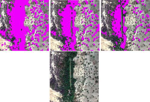
This article proposes a methodology to map tree cover in gazetted forests of Burkina Faso using open access multispectral satellite imagery and Google Earth Engine platform. This methodology could be used to measure changes in tree cover over a period in areas with sparse vegetation.